Revolutionizing surveying & mapping with point cloud software
Precision, efficiency and seamless collaboration are indispensable in the world of surveying and mapping. As technology continues to advance, the emergence of cutting-edge solutions like point cloud scanners has revolutionized the landscape of these industries.
This innovative point cloud software is reshaping traditional practices and unlocking an abundance of benefits for professionals worldwide. Let’s explore how this innovative software is revolutionizing the industry.

Rapid data acquisition and processing
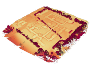
Gone are the days of painstakingly collecting measurements manually. Scanning technology empowers surveyors and mapping professionals to rapidly capture extensive datasets through scanning point cloud platforms. By leveraging sophisticated scanning equipment, users can swiftly gather precise measurements of landscapes, structures, and environments with unparalleled speed and accuracy. Once the data is acquired, the registration software seamlessly imports and processes the results, transforming raw scans into detailed point clouds. This accelerated data acquisition and processing capability not only saves time but also enhances productivity, allowing professionals to focus on analysis and interpretation rather than data collection.
Moreover, the point cloud software’s advanced algorithms add an extra layer of efficiency by automatically recognizing objects within the point cloud. This innovative feature allows users to group objects effortlessly, facilitating streamlined workflows. Whether isolating specific objects, rendering them invisible, or highlighting key features, the software empowers users to manipulate data with unparalleled ease and precision.

Sharing point clouds for enhanced collaboration
One of the standout features of point cloud software is its ability to facilitate seamless collaboration by allowing users to share point cloud data effortlessly. This capability enables teams to work together on the same dataset, regardless of geographical location or time zone. Whether it’s architects, engineers, or urban planners, everyone involved in the project can access and work with the most up-to-date point cloud information, ensuring alignment and accuracy throughout the process. This collaborative approach not only streamlines workflows but also promotes better decision-making and project outcomes.

Efficient data cleanup and preparation
In the world of surveying and mapping, data quality is paramount. Point Cloud Software streamlines the process of data cleanup and preparation, ensuring that datasets are accurate and ready for analysis. With advanced AI tools and algorithms, users can quickly and efficiently clean up point cloud files, removing noise, outliers and unwanted artifacts.
This automated cleanup process not only improves data quality but also reduces manual effort and potential errors. As a result, professionals can trust that their datasets are reliable and ready for further analysis or visualization.

Seamless handoff in the workflow
In the world of surveying and mapping, data quality is paramount. Point Cloud Software streamlines the process of data cleanup and preparation, ensuring that datasets are accurate and ready for analysis. With advanced AI tools and algorithms, users can quickly and efficiently clean up point cloud files, removing noise, outliers and unwanted artifacts.
This automated cleanup process not only improves data quality but also reduces manual effort and potential errors. As a result, professionals can trust that their datasets are reliable and ready for further analysis or visualization.
Getting curious?
Want to know how point cloud platforms can improve your productivity? Take a tour and discover how Pointorama can revolutionize the way you work. So, let’s get started and take a closer look at what we have to offer!
Start your free trialRelated articles
LiDAR: How the use of laser pulses can lead to accurate landscape analysis
When I ask you to think about laser pulse technology, you’ll probably envision some big satellite or space station. But what if I tell you that nowadays, you can even find a laser scanner in your Iphone!
In this article we’ll tell you all about LiDAR, and why you probably should be using it.

How to capture a point cloud
Point clouds have emerged as a crucial tool in various industries, revolutionizing the way we perceive and analyze spaces. In this article, we’ll look into the process of creating point clouds to explore three main acquisition methods.

Choosing the right point cloud format
In this blog post, we’ll delve into the world of point cloud formats, offering some insights into each. We’ll also provide personalized advice on which format might suit you best.