How are Point Clouds Created: A Quick Guide
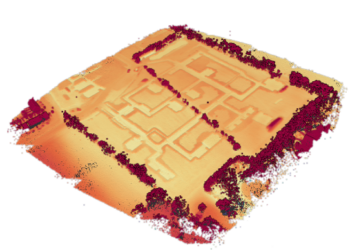
Point clouds have emerged as a crucial tool in various industries, revolutionizing the way we perceive and analyze spaces. A point cloud is a collection of data points. These clouds of points provide valuable insights and are used in fields like surveying, engineering, architecture and environmental sciences. In this article, we’ll look into the process of creating point clouds to explore three main acquisition methods.

Different acquisition techniques
Laser Scanning: A Key Method
One of the primary methods for acquiring point clouds is terrestrial laser scanning. Most commonly used scanners are static 3D laser scanners and scanners mounted on a vehicle or under a UAV or an airplane. These laser scanners are also known as LiDAR (Light Detection and Ranging). Handheld laser scanners used for mobile mapping can also create point clouds. These small mobile scanners capture the data when the operator moves around an object or inside the survey area. Combined with SLAM (synchronized localization and mapping), mobile mapping results in a 3D point cloud with a high level of detail.
LiDAR emits laser pulses that reflect and return back to the sensor. This allows a surveyor to measure distances to the Earth’s surface, buildings, or other objects. The measurements are then compiled to create accurate and detailed point clouds. Laser scanning is used extensively in topographic mapping, forestry, and environmental monitoring.
The advantage of this measuring technique is that it is not so weather dependent since it is an active instrument that emits beams by itself. Lidar can pass through shallow clouds, making it almost independent from weather conditions.
Point clouds from Lidar are commonly saved as a LAS, LAZ or an e57-file, but other file formats can also be used. (link)
Photogrammetry: Capturing 3D Data Through Imagery
Photogrammetry basically equals capturing 3D data through a series of overlapping photographs. These photographs are taken by a hi-def camera with precise positioning equipment. Special software processes these images, identifying common points and reconstructing a 3D model, which is then transformed into a point cloud. Photogrammetry is very versatile and can be conducted using drones and airplanes, making it valuable for land surveying, construction, and archaeological applications.
The biggest advantage of photogrammetry by far is the speed. It allows surveyors to easily capture a lot of data.
File formats from point clouds generated through photogrammetry are the same as regular point clouds.
Lidar and photogrammetry don’t exclude one another. To the contrary, they are often used together to add extra information resulting in better surveys with more details.

Sonar Technology: Unveiling the Depths
In underwater environments, sonar technology is utilized to generate point clouds. Sonar stands for Sound Navigation and Ranging. Similar to Lidar, sonar systems emit and receive a signal and utilize it to determine a distance. In the case of sonar this is a sound wave that bounces off objects in the water, measuring the time it takes for the waves to return.
We can distinguish two main techniques that can generate a point cloud:
- Single beam: echosounder that is mostly used for shallow water survey, covers parts of seabed to define the harder sandy bottom and the softer, muddy layer on top of the sandy bottom
- Multibeam: multiple echosounders used for deeper surveys to cover an entire part of a seabed and thus defining an underwater map
Since bathymetric point clouds are commonly used for mapping purposes and are often the result of a gridded export, they only require three-dimensional data. There is no need for compression with these point clouds, so the file types associated with these techniques are basic text file formats such as PTS, and XYZ.

In a world where data is more important than anything, point clouds play a crucial role. Through laser scanning, photogrammetry, and sonar technology, these 3D data representations are thoroughly crafted, offering profound insights across a lot of sectors. From mapping landscapes to exploring the depths of oceans, point clouds help us to understand our surroundings like never before. As technology advances, more and larger datasets with new possibilities are created. Larger datasets can be processed at a much higher speed with the help of AI algorithms. We are already seeing survey hardware being used in daily use objects such as cars and robot vacuum cleaners
We are living in exciting times with constantly evolving techniques. A future of enhanced understanding and innovation in different domains. The future looks promising!
All images in this blog post are created by AI.
Related articles
LiDAR: How the use of laser pulses can lead to accurate landscape analysis
When I ask you to think about laser pulse technology, you’ll probably envision some big satellite or space station. But what if I tell you that nowadays, you can even find a laser scanner in your Iphone!
In this article we’ll tell you all about LiDAR, and why you probably should be using it.

Choosing the right point cloud format
In this blog post, we’ll delve into the world of point cloud formats, offering some insights into each. We’ll also provide personalized advice on which format might suit you best.

Revolutionizing surveying & mapping with point cloud software
Innovative point cloud software is reshaping traditional practices and unlocking an abundance of benefits for professionals worldwide. Let’s explore how this innovative software is revolutionizing the industry.