Indoor mapping with Pointorama’s 3D floor plan tool
In the world of surveying and 3D scanning, precision and productivity are paramount. Pointorama’s newest feature is here to redefine how surveyors, contractors, and 3D scanning professionals analyze point cloud data. This breakthrough tool streamlines workflows, slashes processing time, and sets a new benchmark for accuracy—all while offering an intuitive interface that simplifies navigation, enhances user control, and accelerates learning curves.

What does the 3D floor plan tool do?
The 3D floor plan tool focuses on creating precise floor plans directly from 3D point clouds. Traditionally, surveyors had to manually trace floor outlines and adjust linework—a time-consuming and error-prone process. With Pointorama’s 3D floor plan tool, this process is fully automated.
Position a plane within the 3D scan, and the tool automatically detects and highlights walls, structural elements, and other key features in the point cloud. It than automatically generates clear, vectorized floor plans. Users can visualize the scan in 3D, define boundaries by selecting specific walls, floors, or sections within the scan, and let the software handle the rest. This approach ensures unparalleled accuracy, even for complex indoor environments or sloped surfaces.

What are the key benefits?
- Time-saving automation: No more manual tracing or guesswork. With just a few clicks, the 3D floor plan tool generates precise floor plans in a fraction of the time it would take using traditional methods.
- Unmatched accuracy: The system’s plane-detection algorithm ensures perfect alignment of walls, floors, and surfaces, reducing the chance of human error.
- Versatile application: Handle everything from flat floors to sloped surfaces with ease. Whether it’s indoor layouts, rooftop footprints, facade plans, cross-section plans or complex multi-level environments, this tool excels in every scenario.
- Easy customization: Need to define unique layout parameters? The 3D floor plan tool allows users to customize dimensions, wall thickness, height, and other critical elements to suit any project requirement.


Why is it better than existing solutions?
Current market solutions often require users to manually trace over 2D section views or orthophotos, making the process slow and prone to errors. Many tools only generate rough outlines, which require extensive manual adjustments. In contrast, Pointorama’s 3D floor plan tool creates ready-to-use, precise vector plans from point clouds with minimal input.
Unlike other systems, Pointorama’s tool can handle flat, sloped, and multi-level surfaces with the same level of precision. Its 3D visualization ensures users can see exactly how the floor plan is being generated, providing greater confidence in the final output. This seamless workflow eliminates the need for costly rework, accelerates project timelines, and enhances overall accuracy.
Want to try it out?
Don’t just take our word for it—experience the precision and speed of the tool for yourself. The 3D floor plan tool is now available for live testing. Visit to schedule a demo or request access to the trial version. See firsthand how this tool can transform your workflow, reduce errors, and boost your productivity.
Take control of floor plan creation
With Pointorama’s 3D floor plan tool, managing and creating precise floor plans has never been easier. Say goodbye to manual intervention and hello to an era of speed, precision, and adaptability. Whether you’re a surveyor, contractor, or 3D scanning professional, this tool is designed to meet your needs and exceed your expectations.
Try it today and see how Pointorama’s cutting-edge technology can redefine your workflow. Ready to take the next step? Book your demo or start your free trial.
Book a demo Start your free trial
Want to go deeper?
Dive into the fundamentals of indoor mapping and better understand the technology behind the workflow.
Download our free white paper and discover how scanning, point clouds and floor plan generation come together.
Related articles

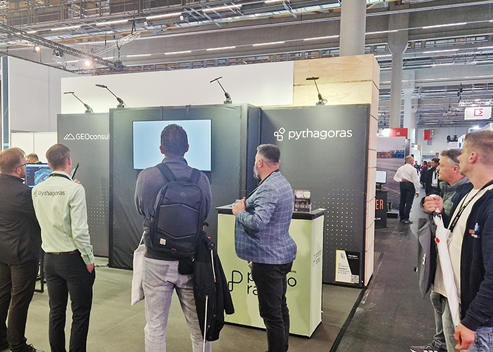
GEO Business 2026 recap: Why our latest Pointorama release turned heads
At GEO Business 2026, Pointorama showcased its latest release, demonstrating how professionals can transform point clouds into accurate floor plans, measurements and deliverables within a single platform. Discover the new features, the industry’s biggest challenges, and how AI-powered automation is helping teams work faster and more efficiently.

Stronger together: how partnerships drive innovation at Pointorama
Partnerships are the driving force behind innovation at Pointorama. By connecting hardware, software and expertise, we transform raw scan data into structured, usable results through seamless workflows.
Pointorama on tour: meet us at key events in 2026
Meet Pointorama at key events in 2026. Discover new features, explore innovations and connect with our team across Europe.In 2026, Pointorama will be present at leading geospatial events across Europe, including GeoBusiness, Intergeo and Trefdag Digitaal Vlaanderen. Discover our latest innovations, explore new workflows and experience how much our technology has evolved when you meet us in person.